
Atlas 2027 represents the mammoth undertaking to renew the classic 1994 Geological Atlas of the Western Canada Sedimentary Basin, published by the Canadian Society of Petroleum Geologists and the Alberta Research Council (predecessors to the Canadian Energy Geoscience Association (CEGA) and the Alberta Geological Survey (AGS)). Like the previous Atlas, this version will take seven years to compile, require support from multiple agencies, and thousands of hours of commitment from hundreds of authors and volunteers. Combined with the data of hundreds of thousands of wells, outcrop observations, and remote sensing, the final result will be one of the most extensive geological treatises ever published.
The Geological Atlas of the Western Canada Sedimentary Basin has been an essential tool for geologists working the basin for nearly 30 years. Its job was simple, to give the reader a first understanding of the rich geological history of the basin from British Columbia to Manitoba, region by region, layer by layer, from the Precambrian to Quaternary. By fulfilling that simple role of enabling access to the best scientific knowledge available, the 1994 geological atlas has played a significant part in the development of the basin – and in turn, the economic well being of many organizations, the provinces, and the country. Following on from the original version in 1964, the Atlas that many are familiar with is the second incarnation, published in 1994. Its 510 oversized (17×22 inches) pages filled a knowledge vacuum by putting areas throughout the basin into large-scale context. This broad, regional perspective was often missed in scientific papers pursuing a narrow focus, forcing the researcher to seek an overview through multiple, disjointed sources. With the release of the 1994 Atlas, geoscientists unfamiliar with an area now had a reliable source of the highest quality information, formatted and expressed in a consistent form throughout the document.
Resource targets have changed in the years since the 1994 edition. At that time, heavy oil plays at Fort McMurray were in their infancy and coalbed methane potential had yet to be fully realized; similarly, shale gas had yet to become a major focus of the basin. More recent shifts in focus to reflect the interest in green energy is also changing where and how we explore the basin, whether it is for products such as hydrogen, helium, and lithium, or processes such as geothermal energy and carbon storage. These factors have highlighted the need for a new edition of the Atlas, one that incorporates the historic values of the previous two editions but looks to the future.
Among the many drivers to produce a third iteration of the Atlas is the massive increase in available data, gathered from almost three decades of academic research and a quadrupling of well data, often targeting areas or subjects that were poorly understood in the previous versions, such as those related to deeper-water facies. Authors of the new Atlas will also be able to take advantage of advancements in data analysis and GIS techniques that allow large volumes of geological data to be processed and inspected for quality using a fraction of the time and human resources that were required in 1994.
Like its 1964 and 1994 predecessors, Atlas 2027 will be ‘open information’, with the target of being available to anyone who needs the data. For this reason, it will primarily be an online entity, but will be much more then the limited products that are currently available with the 1994 Atlas (available through both the AGS and the CEGA websites). Gigabytes of data presented in the maps and cross-sections will be openly available for download and usable on multiple platforms.
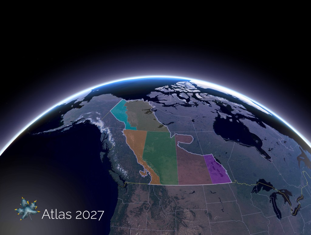
This third edition will also fill in some gaps evident from the previous. The Mackenzie Corridor will be included to reach the true northern extent of the Western Canada Sedimentary Basin, supported in no small part by the Geological Survey of Canada and the Northwest Territories and Yukon Geological Surveys (see Figure 1). Several committees have been formed to oversee the development of the Atlas. Over 60 chapters have been proposed, led by nearly two hundred authors, from a diverse mix of government agencies, academic institutions, private companies, and enthusiastic individuals. As the project develops, each of the chapters will require further assistance from a variety of talents such as graphic arts, editing, document layout, GIS developers – to name a few.
The Canadian Energy Geoscience Association celebrates its centenary in 2027 and a new edition of the Geological Atlas – a publication that is the embodiment of CEGA’s mandate to educate and assist its members – is a fitting tribute to the work of the organization’s staff and countless volunteers of the past 100 years.
